Research Area Reference Systems
Reference systems on Earth and in space provide the fundamental framework for referencing geodetic and astronomical observations. Highly accurate realizations of these systems, the so-called reference frames, are of paramount importance for various applications in daily life. These include navigation, positioning and surveying, as well as the realization of height systems and precise time systems, the computation of spacecraft and satellite orbits and the operation of early warning systems. Furthermore, accurate and up-to-date reference frames form the backbone for the scientific exploitation of the Earth system by providing the metrological reference for monitoring dynamic processes and climate change impacts, such as ice melting or sea level rise. Theoretical and practical aspects of reference systems and their global and regional realizations have been key topics of DGFI-TUM since decades.
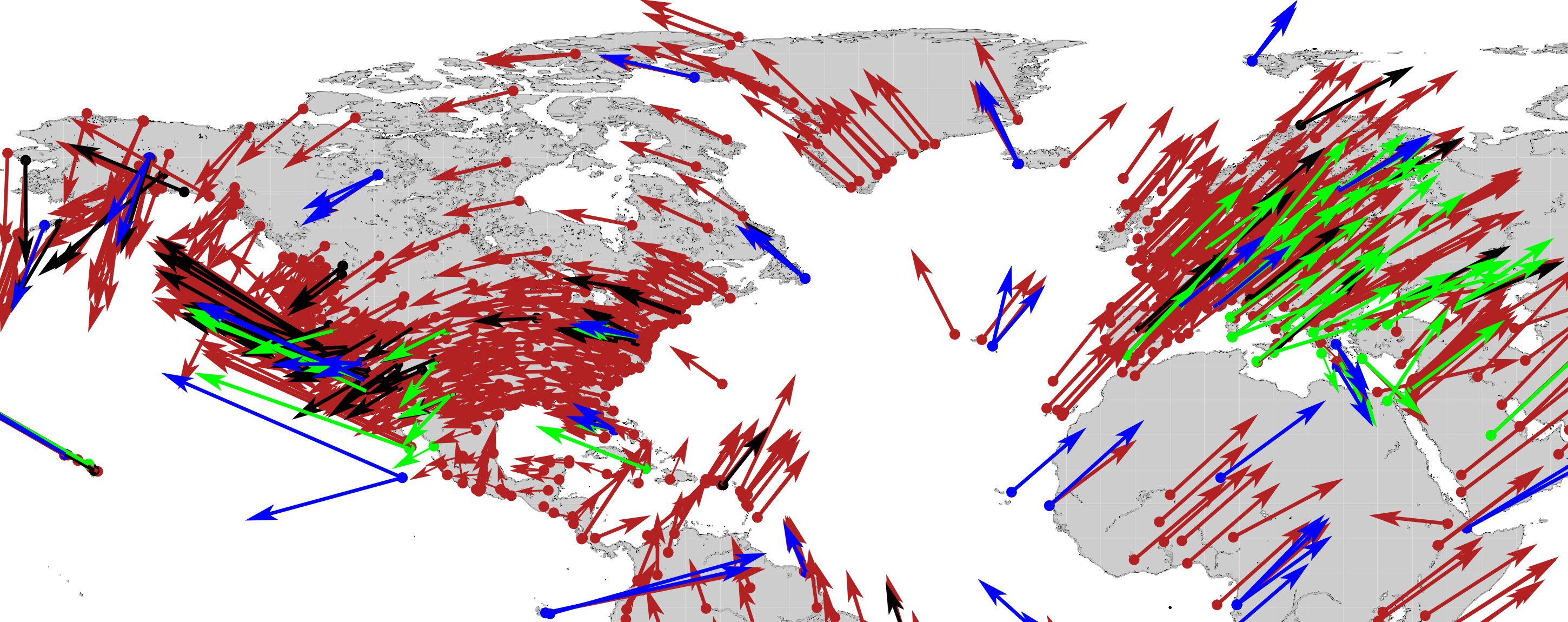
A theoretically defined coordinate system (reference system) is realized in the form of concrete points (markers) attached to the solid Earth crust with precisely determined coordinates. Physical processes, such as plate tectonics or tidal deformations, cause all points on the Earth surface to undergo permanent changes over time. Hence, a reference frame typically also includes information about the temporal variations of the coordinates.
The space geodetic observation techniques, such as Very Long Baseline Interferometry (VLBI), Satellite and Lunar Laser Ranging (SLR/LLR), Global Navigation Satellite Systems (GNSS) with the microwave techniques GPS, GLONASS, and Galileo as well as the system Doppler Orbitography and Radio positioning Integrated by Satellite (DORIS) provide the basis for the work within this research field. The geometric techniques allow for determining the geometrical figure of the Earth continuously and with high precision (at the mm-level). Hence, they enable to identify and quantify even the smallest variations in space and time. A fundamental requirement and the principal goal of DGFI-TUM's research in this field are highest accuracies, long-term stability and consistency for the full processing chain of the space geodetic observations and their combination.
The research area Reference Systems is primarily concerned with the determination and analysis of geometric parameters describing the shape and orientation of the Earth. Furthermore DGFI-TUM is strongly engaged in the determination of precise satellite orbits from SLR and DORIS observations. With the inclusion of the research activities and developments of the Geodetic Observatory Wettzell in the framework of the FGS, the complete processing chain from observation techniques and procedures, data acquisition, preprocessing and provision, development of models and mathematical algorithms for data analysis, combination and orbit computation is covered.
DGFI-TUM's research also aims at leading the way towards the further development of reference frames. Main research tasks are the joint realization of the terrestrial reference frame (TRF) and celestial reference frame (CRF) and the integration of geometry and gravity. The latter aspect includes the combination of geometry with physical heights and the physical datum realization of future reference frame solutions.
Arcisstraße 21
80333 München