SLR Data Analysis
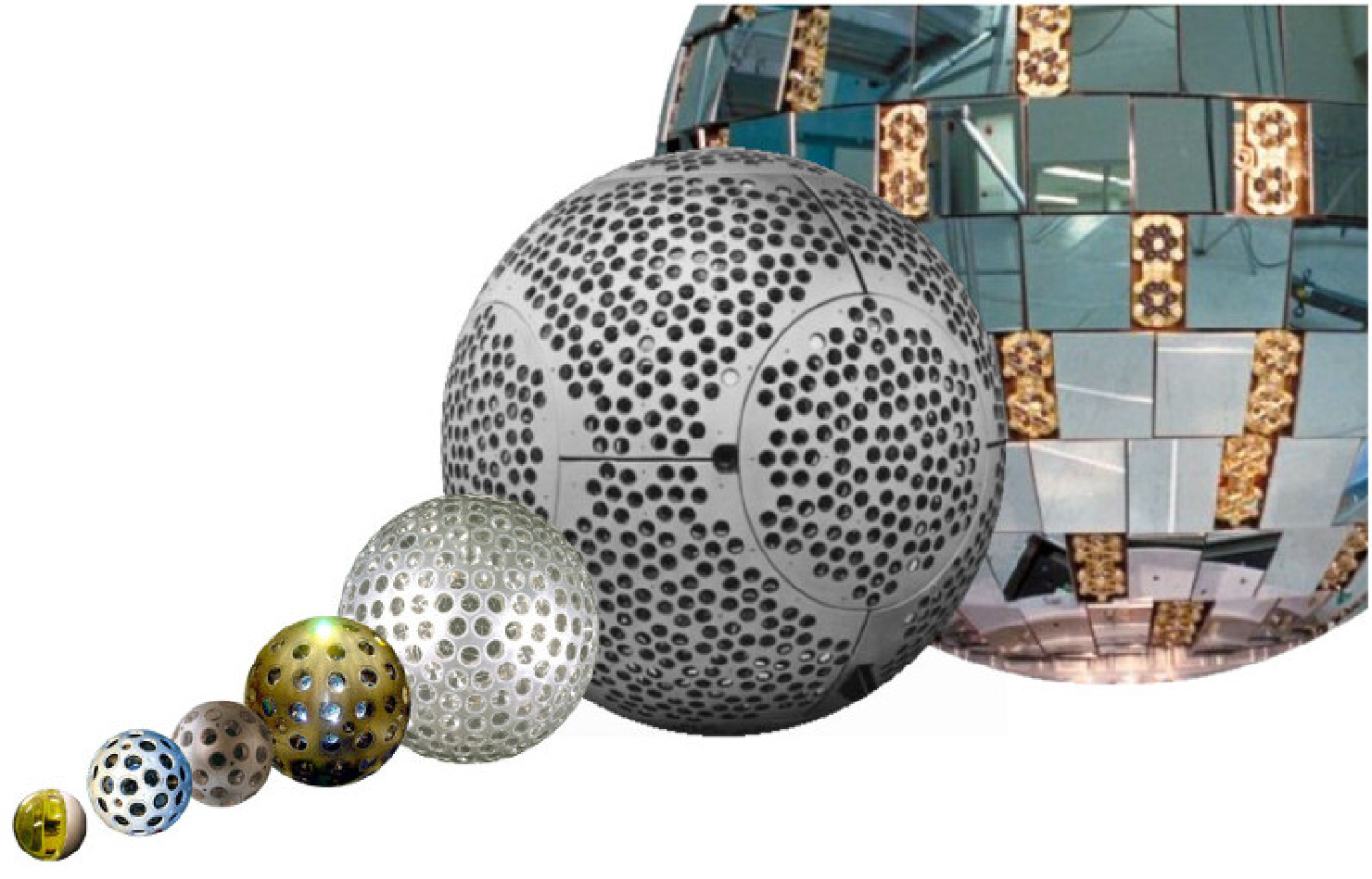
DGFI-TUM routinely analyses Satellite Laser Ranging (SLR) observations to numerous (geodetic) spherical and non-spherical near-Earth satellites. The routine operations, as well as related research tasks, rely on the in-house 'DGFI Orbit and Geodetic parameter estimation Software' (DOGS-OC). Examples for spherical satellites processed at DGFI-TUM are the LAser GEOdynamics Satellite 1 and 2 (LAGEOS-1/-2), Etalon 1 and 2, LAser RElativity Satellite (LARES), Larets, Stella, Starlette, Ajisai, Ball-Lense-In-The-Space (BLITS), GFZ-1, and Westpac-1 (see Figire). All these satellites are orbiting the Earth in altitudes between 600 km and 20,000 km. They are equipped with different types of laser reflectors and differ with respect to diameter and mass. Examples for non-spherical satellites processed at DGFI-TUM are the altimetry satellite missions Topex/Poseidon and the satellites of the Jason family.
Related projects
Selected Publications
Bloßfeld M., Kehm A.: ILRS Analysis Activities. DGFI-TUM (Deutsches Geodätisches Forschungsinstitut – Technische Universität München), Germany. In: Noll C., Pearlman M. (Eds.), International Laser Ranging Service 2016–2019 Report, 2020
Bloßfeld M., Zeitlhöfler J., Rudenko S., Dettmering D.: Observation-Based Attitude Realization for Accurate Jason Satellite Orbits and Its Impact on Geodetic and Altimetry Results. Remote Sensing, 12(4), 682, 10.3390/rs12040682, 2020
 (Open Access)
(Open Access)
Dill R., Dobslaw H., Hellmers H., Kehm A., Bloßfeld M., Thomas M., Seitz F., Thaller D., Hugentobler U., Schönemann E.: Evaluating Processing Choices for the Geodetic Estimation of Earth Orientation Parameters with Numerical Models of Global Geophysical Fluids. Journal of Geophysical Research: Solid Earth, 125(9), 10.1029/2020JB020025, 2020
(Open Access)
(Open Access)
Ferrándiz J. M., Modiri S., Belda S., Barkin M., Bloßfeld M., Heinkelmann R., Schuh H.: Drift of the Earth’s Principal Axes of Inertia from GRACE and Satellite Laser Ranging Data. Remote Sensing, 12(2), 314, 10.3390/rs12020314, 2020
(Open Access)
(Open Access)
Kehm A., Bloßfeld M., König P., Seitz F.: Future TRFs and GGOS – where to put the next SLR station?. Advances in Geosciences, 50, 17–25, 10.5194/adgeo-50-17-2019, 2019
(Open Access)
(Open Access)
Pearlman M. Arnold D. Davis M. Barlier F. Biancale R. Vasiliev V. Ciufolini I. Paolozzi A. Pavlis E.C. Sośnica K. Bloßfeld M.: Laser geodetic satellites: a high-accuracy scientific tool. Journal of Geodesy, 93(11), 2181-2194, 10.1007/s00190-019-01228-y, 2019
Deutsches Geodätisches Forschungsinstitut
Prof. Dr.-Ing. habil. Florian Seitz
Technische Universität München
Arcisstraße 21
80333 München
Arcisstraße 21
80333 München