VLBI Data Analysis
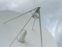
Very Long Baseline Interferometry (VLBI) is one of the four geodetic space techniques that are used to establish the terrestrial reference frame (TRF). Furthermore, VLBI is capable of both determining the celestial reference frame (CRF) and directly connecting TRF and CRF via estimates of nutation and all Earth rotation parameters, in particular the variations of the Earth’s angular velocity (UT1-UTC). These last two properties are an unique feature of VLBI among all techniques.
One of the major scientific ambitions of DGFI-TUM in the field of VLBI data analysis is the joint realization of CRF and TRF pursuant to Resolution R3 (2011) of the International Union of Geodesy and Geophysics (IUGG) according to which the highest consistency between the ICRF and the ITRF as well as the Earth Orientation Parameters should be a primary goal in all future realizations of the ICRF. In this context, DGFI-TUM co-chairs the IAG/IAU/IERS Joint Working Group on the Consistent Realization of TRF, CRF, and EOP.
Another focus is the application of non-tidal (atmospheric, oceanic, and hydrological) loading in VLBI data analysis, which still is not a conventional but definitely beneficial approach.
DGFI-TUM is one of ten operational Analysis Centers of the International VLBI Service for Geodesy and Astrometry (IVS). As such, DGFI-TUM actively contributes to operational products, in particular by submitting normal equations for the rapid turnaround sessions to the BKG/DGFI-TUM IVS Combination Center. Furthermore, DGFI-TUM participates in international working groups and projects, such as the latest realizations of the International Terrestrial Reference System (ITRF2020, DTRF2020). In this context, DGFI-TUM consistently reprocesses more than 6,000 VLBI sessions of the years 1979–2020, and investigates the specific impact of new geophysical and instrumental models.
Since 2018, VLBI analyses at DGFI-TUM are performed with the DOGS-RI (Radio Interferometry) software, designed and implemented by the VLBI analysis group at DGFI-TUM. DOGS-RI is part of the "DGFI Orbit and Geodetic parameter estimation Software" (DOGS) and enables a consistent analysis of VLBI, SLR and DORIS data. The software is continuously updated to comply with the latest geophysical models and conventions. Formerly, VLBI analyses at DGFI-TUM were performed with the OCCAM VLBI software that has been developed by various groups and authors over many years.
Selected Publications
 (Open Access)
Arcisstraße 21
80333 München