Determination of Satellite Orbits
Precise satellite orbits are a prerequisite for determining reliable geodetic parameters from satellite observations, such as station coordinates, Earth Orientation Parameters (EOP), or coefficients of the Earth's gravity field. They are also fundamental for satellite-based observations of geodynamics and climate impacts, such as sea level changes in the order of millimeters.
DGFI-TUM computes satellite orbits from Satellite Laser Ranging (SLR) and Doppler Orbitography and Radiopositioning Integrated by Satellite (DORIS) observations using the DOGS-OC (Orbit Computation) software, which is part of the "DGFI Orbit and Geodetic parameter estimation Software" (DOGS). Calculations are carried out both separately for each observation technique and in combined analyses.
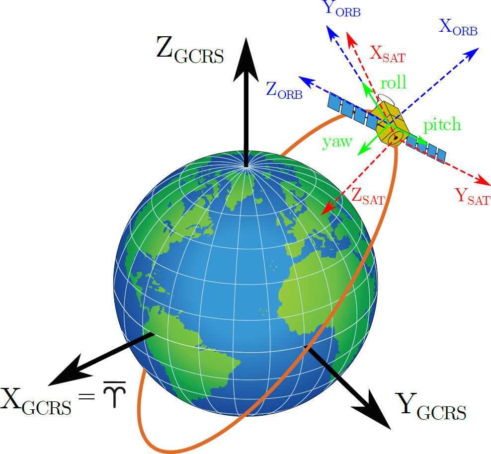
In recent years, DGFI-TUM has expanded its capabilities to analyze non-spherical satellites equipped with active attitude control in addition to spherical passive geodetic satellites such as Etalon 1/2, Lageos 1/2, and several others. In Earth observation applications, such as the monitoring of the sea level using altimeter satellites, the accurate knowledge of the satellite orbit as well as of the orientation of the instrument during the measurement are of crucial importance. Within the precise orbit determination (POD), careful modeling of the orientation of the satellite body and solar panels is required to determine the spacecraft's effective area in the direction of flight for an accurate calculation of non-gravitational perturbations. This task requires several transformations between diverse reference frames (see Figure). Besides SLR and DORIS observations, various additional data such as star camera measurements, optical and infrared properties and atomic characteristics of the satellite panel regions, solar panel rotation angles and propellant consumption need to be taken into account.
DGFI-TUM is providing orbit predictions for all spherical SLR-tracked satellites in orbit to the International Laser Ranging Service (ILRS) to improve the tracking capabilities at SLR stations.
Related projects
- Mitigation of the current errors in precise orbit determination of altimetry satellites (MEPODAS)
- Development of High-precision Thermosphere Models for Improving Precise Orbit Determination of Low-Earth Orbiting Satellites (TIPOD)
- Consistent dynamic satellite reference frames and terrestrial geodetic datum parameters
Arcisstraße 21
80333 München