Monitoring the Arctic Seas: Satellite Altimetry traces open water in sea-ice regions
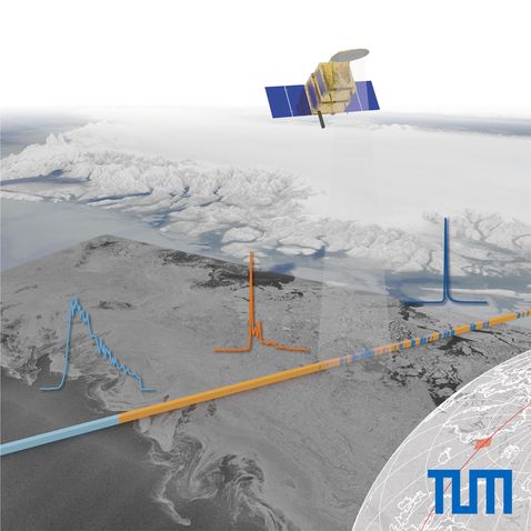
Open water areas in sea ice regions significantly influence the ocean-ice-atmosphere interaction. For the debate about Arctic climate change, the monitoring and quantification of such openings, so-called leads and polynyas, is of high relevance.
In a recent study, scientists from DGFI-TUM demonstrated the potential of high-frequency satellite altimetry data from the missions SARAL and Envisat for the detection of open water areas in the ice-covered Greenland Sea. In comparison with Synthetic Aperture Radar (SAR) images, they obtained a consistency rate of 76.9% for SARAL and 70.7% for Envisat. Some samples even resulted in true water detection rates of up to 94%.
The study is based on an innovative, unsupervised classification approach that relates the radar altimetry echoes (so-called waveforms) with different surface conditions, among them open water and sea ice. The algorithm has successfully been used for the detection of water areas with different spatial extent, and it can be applied to all pulse-limited altimetry data sets. The procedure and results are described in the article Monitoring the Arctic Seas: How Satellite Altimetry can be used to detect open water in sea-ice regions (Remote Sensing, 2017, available via open access).
Arcisstraße 21
80333 München