High-resolution ionosphere maps for precise GNSS applications
Ionospheric disturbances are the main error source in single-frequency precise point positioning. The International GNSS Service (IGS) and its Ionosphere Associated Analysis Centers (IAAC) routinely provide maps of the Vertical Total Electron Content (VTEC) of the ionosphere to correct for ionospheric influences. Since these maps are based on post-processed observations and final orbits, they are usually disseminated to the user with latencies of days to weeks. Precise dual- and multi-frequency GNSS applications, however, such as autonomous driving or precision farming, require high-resolution ionosphere products in (near) real-time (NRT).
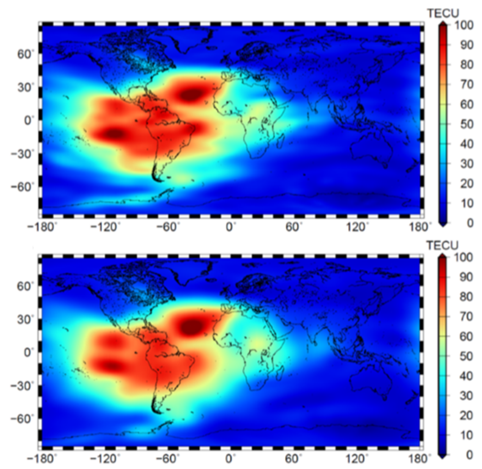
To meet this requirement, scientists of DGFI-TUM developed a new procedure to create NRT high-resolution information about the state of the ionosphere based on raw observation data and ultra-rapid orbits. To consider additionally the inhomogeneous distribution of the GNSS data, DGFI-TUM’s modelling approach is based on localizing basis functions (polynomial and trigonometric B-splines). In this way, in contrast to the aforementioned IAAC products, data gaps can be handled appropriately, and a multi-scale representation (MSR) allows for generating VTEC maps of higher or lower spectral resolution by applying a Kalman filter estimation procedure and the pyramid algorithm known from wavelet decomposition.
The realization of the MSR and the generation of the VTEC maps with different temporal and spectral resolutions (Figure) are presented in the article High-resolution vertical total electron content maps based on multi-scale B-spline representations (Annales Geophysicae, 2019, doi: 10.5194/angeo-37-699-2019, [PDF]). The latency of DGFI-TUM’s high-resolution product amounts to only 2-3 hours. A validation against the most prominent final and rapid products from the IAACs in Berne (CODE) and Barcelona (UPC) revealed a quality improvement of a few TECU, where a variation of 1 TECU [=10^16 electrons/m^2] corresponds to an error of around 16 centimeters in the distance between a GNSS satellite and a receiver on the Earth’s surface.
Arcisstraße 21
80333 München