Surface currents in polar oceans from satellite altimetry complemented by ocean modelling:
A new dataset for the northern Nordic Seas
Deeper knowledge about geostrophic ocean surface currents in the northern Nordic Seas supports the understanding of ocean dynamics in this region characterized by rapidly changing environmental conditions. Monitoring the sea-ice-affected area by satellite altimetry results in fragmented and irregularly distributed data sampling and prevents the creation of homogeneous and highly resolved spatio-temporal datasets. In order to overcome this problem, an ocean model can be used to fill in data where altimetry observations are missing.
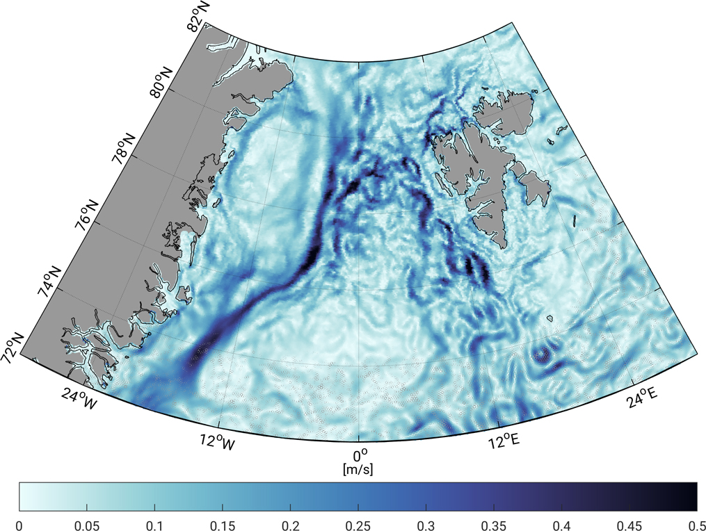
The joint study Geostrophic currents in the northern Nordic Seas from a combination of multi-mission satellite altimetry and ocean modeling (Earth System Science Data, 2019, doi: 10.5194/essd-11-1765-2019, [PDF]) of DGFI-TUM and the Alfred Wegener Institute (AWI) resulted in a novel dataset of geostrophic currents based on a combination of along-track satellite altimetry data and simulated differential water heights from the Finite Element Sea ice Ocean Model (FESOM). The combination approach is based on principal component analysis (PCA) and links the the temporal variability of along-track ocean topography from satellite altimetry with the most-dominant spatial patterns of FESOM differential water heights. Annual variability and constant offsets were removed from both datasets before combination and added back from altimetry to the combined dataset. Surface currents were computed applying the geostrophic flow equations to the combined topography. The resulting final product is characterized by the spatial resolution of the ocean model (around 1 km) and the temporal variability of the altimetry along-track derived DOT heights. Comparisons to in situ surface drifter observations demonstrate good agreement of spatial patterns, magnitude and flow direction. Mean differences of 0.004 m/s in the zonal and 0.02 m/s in the meridional component are observed. A direct pointwise comparison between the combined geostrophic velocity components interpolated to drifter locations indicates that about 94% of all residuals are smaller than 0.15 m/s.
The dataset provides surface circulation information within the sea ice area and will support a deeper comprehension of ocean currents in the northern Nordic Seas between 1995 and 2012. Data are available at https://doi.org/10.1594/PANGAEA.900691.
Arcisstraße 21
80333 München