Reference Systems – the Backbone for Positioning, Navigation and Earth System Research
The fundamental role of reference systems in space geodesy has been expressed already 30 years ago. In a famous article, Kovalevsky [1989] states: "The Earth, its environment and the celestial bodies in the universe are not static: they move, rotate and undergo deformations. Motions and positions are not absolute concepts and can be described only with respect to some reference.”
In the last decades, the measurement accuracy of modern space geodetic techniques has improved by orders of magnitudes. This development requires that today's realizations of reference systems must be accurate at the millimeter level on global scale. Such accuracy is required for precise positioning and navigation on Earth and in space, and it is a prerequisite for the long-term monitoring and quantification of dynamic processes in the Earth system, such as seismic deformations, post-glacial uplift, or global and regional sea level changes.
Triggered by the need of a precise reference on Earth and in space, the DFG research unit “Space-Time Reference Systems for Monitoring Global Change and for Precise Navigation in Space” (FOR1503) aims at developing integrative methods and procedures for a consistent definition and realization of geodetic reference systems as well as to accomplish computations for their establishment and maintenance. This international consortium of scientists now published a 10-article special issue of the Journal of Geodesy. Scientists from DGFI-TUM were involved in two of the published studies:
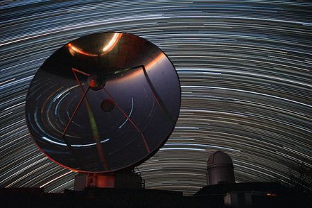
The article Consistent estimation of geodetic parameters from SLR satellite constellation measurements (Journal of Geodesy, 2018, DOI: 10.1007/s00190-018-1166-7) describes the scientific exploitation of satellite laser ranging (SLR) observations to up to 11 satellites with various altitudes and orbit inclinations. The observations are used for the joint estimation of reference frame parameters, satellite orbits, gravity field changes and variations of Earth rotation. In contrast to the standard 4-satellite constellation currently used by the International Laser Ranging Service (ILRS), the extended constellation allows for a significant reduction of correlations between the respective parameters and thus for a higher precision.
One of the key goals of the research unit, the first simultaneous and consistent realization of the global Terrestrial Reference Frame (TRF), the Celestial Reference Frame (CRF) and the Earth orientation parameters (EOP) from the space-geodetic observing techniques VLBI, SLR, GNSS and DORIS is described in the article Consistent realization of Celestial and Terrestrial Reference Frames (Journal of Geodesy, 2018, DOI: 10.1007/s00190-018-1130-6, [PDF]). For the first time, this study realized the IUGG Resolution R3 (2011) which urges that highest consistency between TRF, CRF and EOP should be a primary goal of all future realizations.
Arcisstraße 21
80333 München