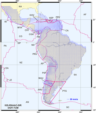
VEMOS2015: Surface deformation model for Latin America after the 2010 earthquakes in Chile and Mexico

Strong earthquakes cause changes in positions (up to several meters) and velocities of geodetic reference stations. Hence, existing global and regional reference frames become unusable in the affected regions. To ensure the long-term stability of the geodetic reference frames, the transformation of station positions between different epochs requires the availability of reliable continuous surface deformation models.
Scientists of DGFI-TUM now published the new continental continuous surface deformation model VEMOS2015 (Velocity Model for SIRGAS [Sistema de Referencia Geocéntrico para Las Américas]) for Latin America and the Caribbean inferred from GNSS (GPS+GLONASS) measurements gained after the strong earthquakes in 2010 in Chile and Mexico. VEMOS2015 is based on a multi-year velocity solution for a network of 456 continuously operating GNSS stations covering a five years period from March 14, 2010 to April 11, 2015. The approach and results are described in the article Crustal deformation and surface kinematics after the 2010 earthquakes in Latin America (Journal of Geodynamics, 2016, DOI: 10.1016/j.jog.2016.06.005).
VEMOS2015 as well as the SIRGAS reference frame realization SIR15P01 (multi-year solution for 456 GNSS stations, including weekly residual time series) are provided in our Science Data Products section. More information on DGFI-TUM's research activities related to SIRGAS can be found here.
Arcisstraße 21
80333 München