Satellite-based time series of volume variations of small inland water bodies
In the debate of climate change impacts, the availability and accessibility of freshwater on Earth is an extremely important topic. About 0.25% of the Earth’s freshwater is stored in lakes and reservoirs. A large fraction of these water bodies is characterized by strong storage changes, not only with the seasons, but also in the long-term in consequence of, e.g., human interference or climate-related phenomena. Furthermore, the number of reported flood events relating to inland waters is steadily increasing, from about 150 in 1980 to more than 400 in recent years. Various tasks, such as water resource management, water supply or civil protection require accurate and current information about water storage. In the light of decreasing ground-based measurements, remote sensing techniques have become extremely relevant for the monitoring of lakes and reservoirs worldwide.
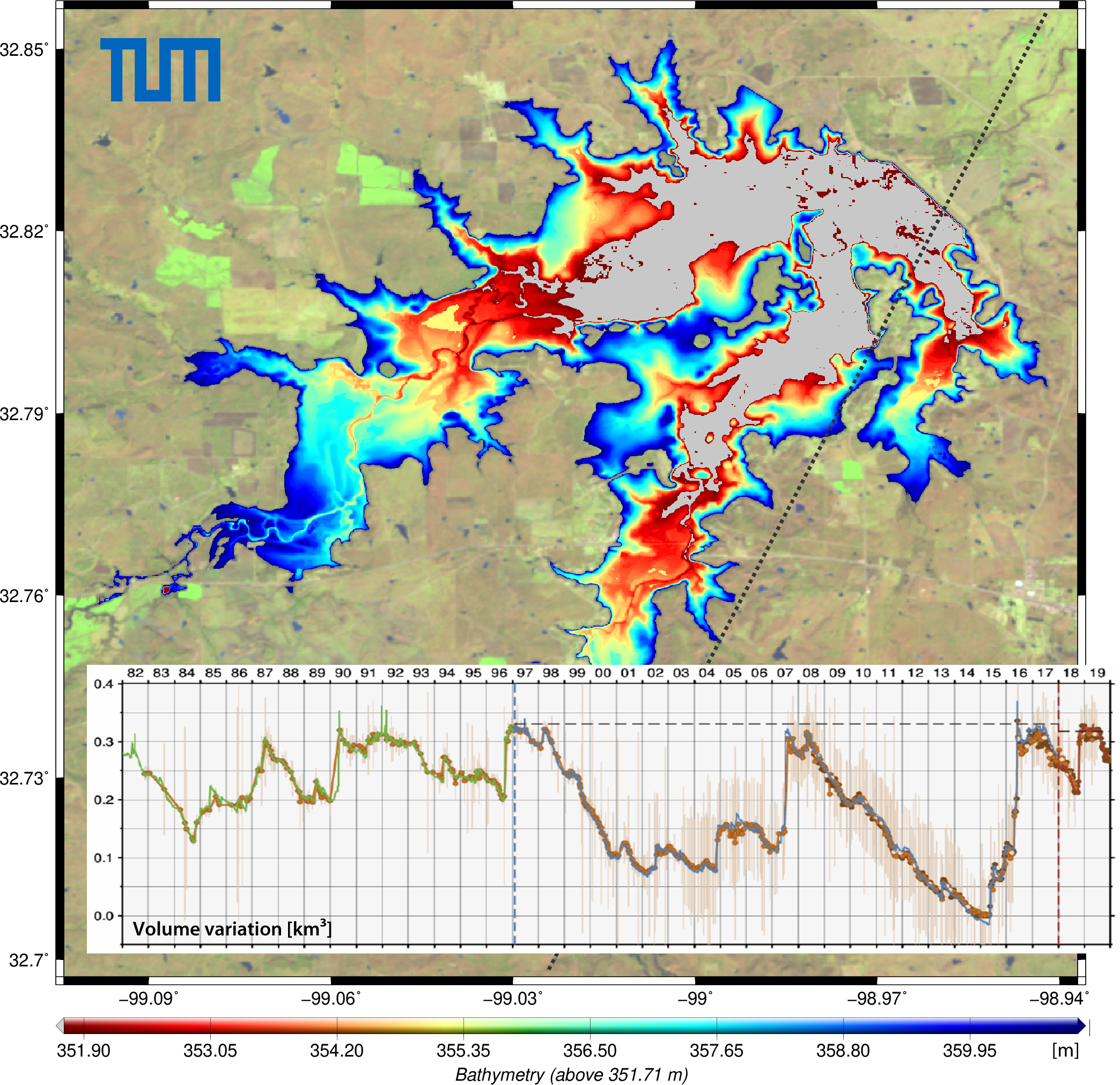
Since many years, DGFI-TUM has been working on the determination of accurate water level changes from satellite altimetry also for small inland water bodies and provides respective time series for more than 2740 targets in its Database for Hydrological Time Series of Inland Waters (DAHITI). A newly developed approach now combines these data with areal information from remote sensing images and thus enables the determination of volume changes. For each water body, the underlying algorithm creates a fixed water level/surface area relation (so-called hypsometry) and a high-resolution bathymetry above the lowest observed water level. Details can be found in the article Volume Variations of Small Inland Water Bodies from a Combination of Satellite Altimetry and Optical Imagery (Remote Sensing, 2020, doi: 10.3390/rs12101606, [PDF]).
The procedure was applied to 28 lakes and reservoirs located in Texas, USA, with volumes between 0.1 km³ and 6.0 km³. Validation with ground data features correlation coefficients between 0.80 and 0.99. The relative errors vary between 1.5% and 6.4% with an average of 3.1%. All data are publicly accessible via DAHITI.
Arcisstraße 21
80333 München