Homogeneous global altimeter sea level record
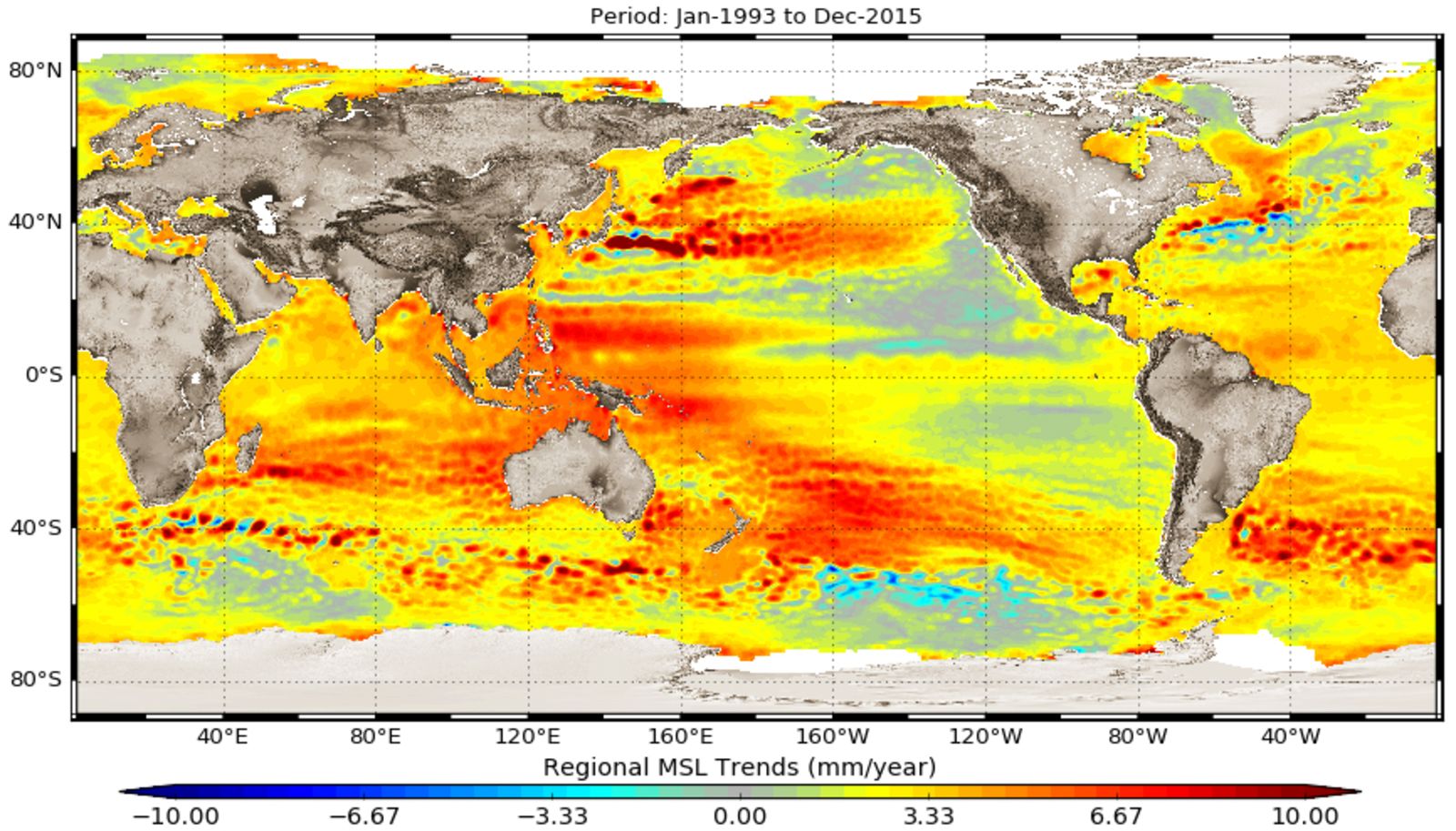
An improved and homogeneous altimeter sea level record has been derived within the second phase of the Sea Level project of the European Space Agency’s Climate Change Initiative. The record covers a 23-year long time span (1993-2015) and is based on the data from nine satellite altimeter missions. It includes the monthly gridded time series of multi-mission merged sea level anomalies at a 0.25° spatial resolution and derived products suitable for climate studies: global mean sea level time series, regional mean sea level trends (see Figure), and maps of the amplitude and phase of the annual and semi-annual signals of the sea level.
The use of improved geophysical corrections and improved orbit solutions, careful bias reduction between missions and inclusion of two new altimeter missions (SARAL/AltiKa and CryoSat-2) improved the sea level products and reduced their uncertainties on different spatial and temporal scales. The derived global mean sea level trend is 3.3 mm/a over the entire time span, the regional sea level trends range between -5 and +10 mm/a.
Scientists of DGFI-TUM contributed to the development of this new sea level record, in particular, by the analysis of new orbit solutions and the assessment of the impact of orbit improvements on regional sea level results. Processing strategy, results, quality assessment and validation of the new data set are described in the open-access publication An improved and homogeneous altimeter sea level record from the ESA Climate Change Initiative (Earth System Science Data, 2018, DOI:10.5194/essd-10-281-2018, [PDF]).
Arcisstraße 21
80333 München