Vertical Land Motion by satellite Altimetry and tide gauge Difference (VLAD)
The impact that sea level rise will have at particular locations depends also on the local movements of the Earth crust, as vertical land motion (VLM) is in many places of the same order of magnitude (1-10 mm/yr) as the sea level rise itself and displays significant spatial variations. Given the potentially hazardous effects of sea level rise, measuring and interpreting the sea level trends relative to the land are vital challenges for climate change understanding and adaptation. To separate the contributions from crustal motions and absolute sea level rise from the in-situ (tide gauges, TGs) observations, geodetic VLM estimates can be used if a coastal geodetic stations and a TG are colocated, which is true for only 5% of the network. To extend the estimations to the other TGs, satellite altimetry, which provides absolute sea level measurements and has a global coverage, can be used in combination by differentiating the sea level time series, assuming that the residuals are due to the land motion (TG-Alt method). The accuracy of this promising application has been hampered by the quality of satellite altimetry data in the coastal zone.
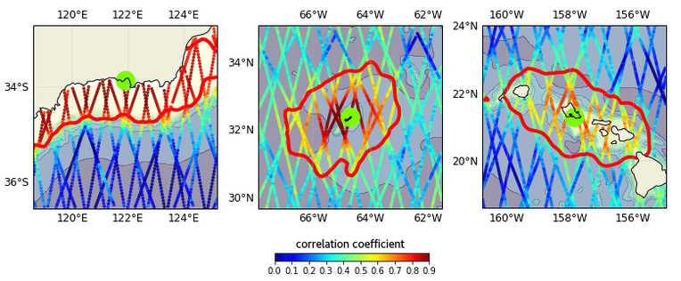
This project aims at providing a VLM map based on TG-Alt using for the first time a coastal-dedicated reprocessing of the altimetry data, including a specialised algorithm to fit the radar signal and an evaluation of the available corrections. A “zone of influence” of the sea level variability for each tide gauge will be defined in order to take into account the short wavelength variations typical of shelf seas and coastal waters, while maximizing the number of altimetry measurements. The uncertainties will be provided by the statistical analysis of TG-Alt residuals. A further aim is to improve the density of the geodetic network by harmonising the solutions of multiple datasets in order to make compatible the vertical motion rates referred to different Terrestrial Reference Frame (TRF) versions. These estimates will then be used as control points to evaluate the TG-Alt VLM map. Finally, the overall purpose is the estimation of relative coastal sea level trends during the “satellite era” (starting from 1993) by combining the altimetry data with the TG-Alt VLM points in a coastal map to be defined in specific regions. The resulting map of relative trends will constitute an innovative tool to be used, for example, for risk assessment studies.
Selected Publications
 (Open Access)
Arcisstraße 21
80333 München