River Discharge
In recent decades, interest in the global freshwater system has increased, both in terms of its role in the Earth system and the sustainable development of water resources in a globalized world. Although rivers store only 0.006% of global freshwater, they provide half of the water for consumption and irrigation. River discharge measurements form the basis for water resource planning and are extremely important for monitoring hydrologic changes in space and time.
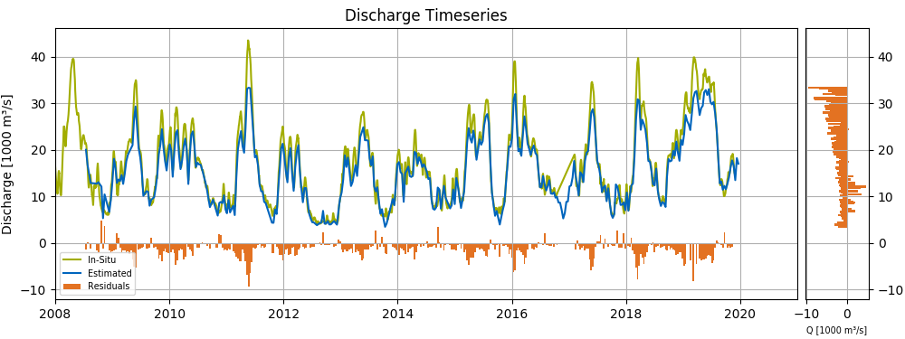
The most important datasets for monitoring river discharge are in-situ discharge time series measured by gauging stations. However, the number of freely available runoff time series in public databases such as the Global Runoff Data Centre (GRDC) has been rapidly decreasing since about 1980.
DGFI-TUM is working on methods to estimate river discharge based solely on satellite data. For this purpose, water levels from satellite altimetry are combined with area information from optical images, incorporating theoretical relationships (hydrodynamic equations). Gauge measurements are used for validation and to study the benefits of in-situ calibration.
Data are made available through the web service DAHITI (Database for Hydrological Time Series of Inland Waters).
Selected Publications
 (Open Access)
Arcisstraße 21
80333 München