DORIS Data Analysis
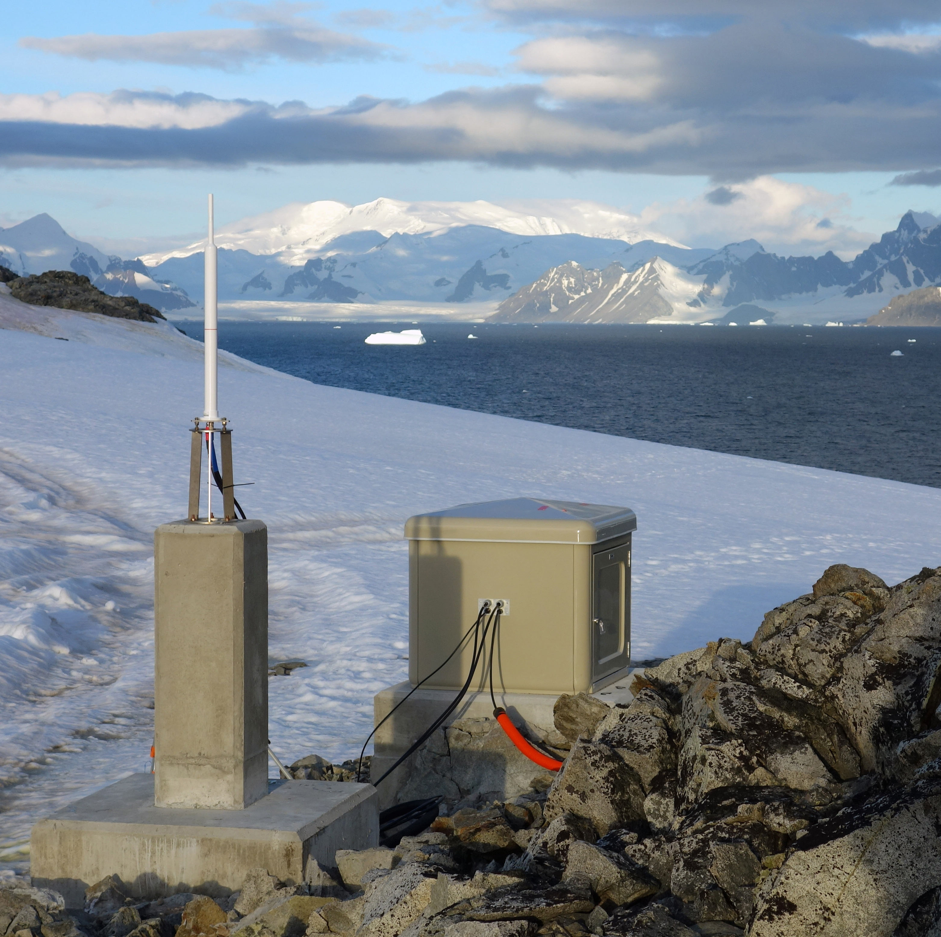
Doppler Orbithography and Radiopositioning Integrated by Satellite (DORIS) is a microwave geodetic observation technique that provides continuous tracking of near-Earth satellites. The DORIS system is a strong geodetic pillar for precise orbit determination (POD) as well as for the computation of coordinates of DORIS stations (microwave beacons, see Figure) in geodetic reference frames.
Since 2018, DGFI-TUM is an official Associated Analysis Center (AAC) of the International DORIS Service (IDS). In this framework, DGFI-TUM regularly analyzes the DORIS observations of various altimetry satellites. Furthermore, DORIS data analysis is an important task in the context of DGFI-TUM's activities in the realization of the International Terrestrial Reference System (ITRS) in its role as an ITRS Combination Center. DORIS data analysis at DGFI-TUM is based on the DGFI Orbit and Geodetic parameter estimation Software (DOGS) that has been enhanced by DORIS analysis capabilities over the past years.
Selected Publications
 (Open Access)
Arcisstraße 21
80333 München