Measurement and modelling of regional deformations
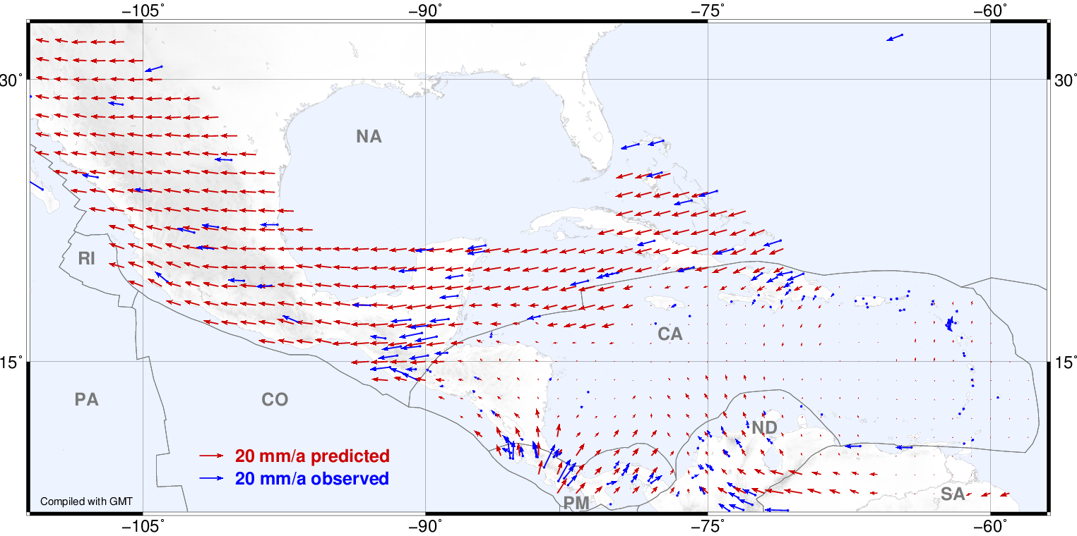
The high precision of geodetic space techniques enables the determination of 3D station positions and their changes over time with mm-accuracy. The analysis of position time series derived from geodetic observations permits the identification and quantification of geophysical effects, such as plate tectonics or mountain building, which shall be appropriately modelled to increase the reliability of the reference frames. These estimates are also very useful to provide input data of high quality for studying the global change and for early warning of natural disasters. The monitoring with regional continuously operating GNSS networks is the most applied strategy for this purpose, since GNSS delivers high-resolution measurements in time and in space with relative low costs. However, to exploit the maximum precision of this technique, a high-quality data processing is necessary together with an adequate distribution of GNSS stations in the region of study and the corresponding operational infrastructure. DGFI-TUM routinely analyses the data from GNSS monitoring networks in Latin America and the Alpine region with the main objective of modelling tectonic processes. This analysis allows also to identify and to understand effects caused by volcanism and seismic events.
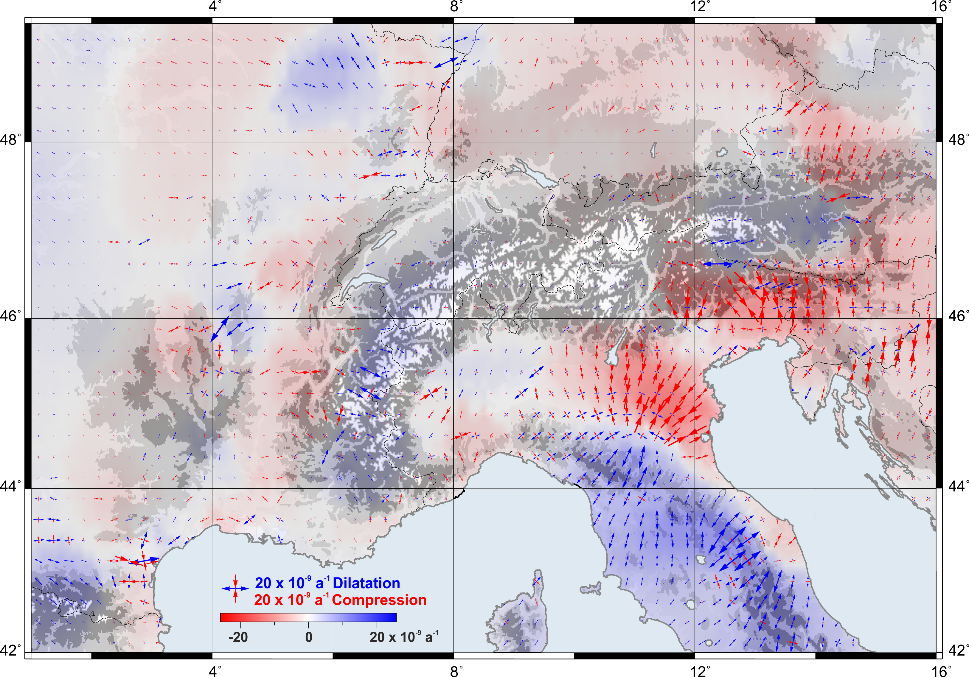
Monitoring crustal deformations in the Alpine Region
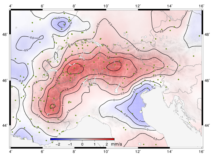
In the frame of the ALPS-GPS QUAKENET project, a component of the Alpine Space Programme of the European Community Initiative Programme (CIP) INTERREG IIIB, DGFI installed in 2005 five continuously operating GPS stations located along the northern Alps boundary which are still in operation. The main objective of this effort was to study crustal deformations in near real-time to improve natural disaster prevention in the Alpine region. DGFI-TUM provides the observational data of its stations to the geoscientific community and applies the data in the context of a comprehensive network of more than 300 GNSS stations in the Alpine region and its forlands in studies of tectonic and mountain building processes.
Selected Publications
 (Open Access)
(Open Access)
(Open Access)
Arcisstraße 21
80333 München