Sea Level Change
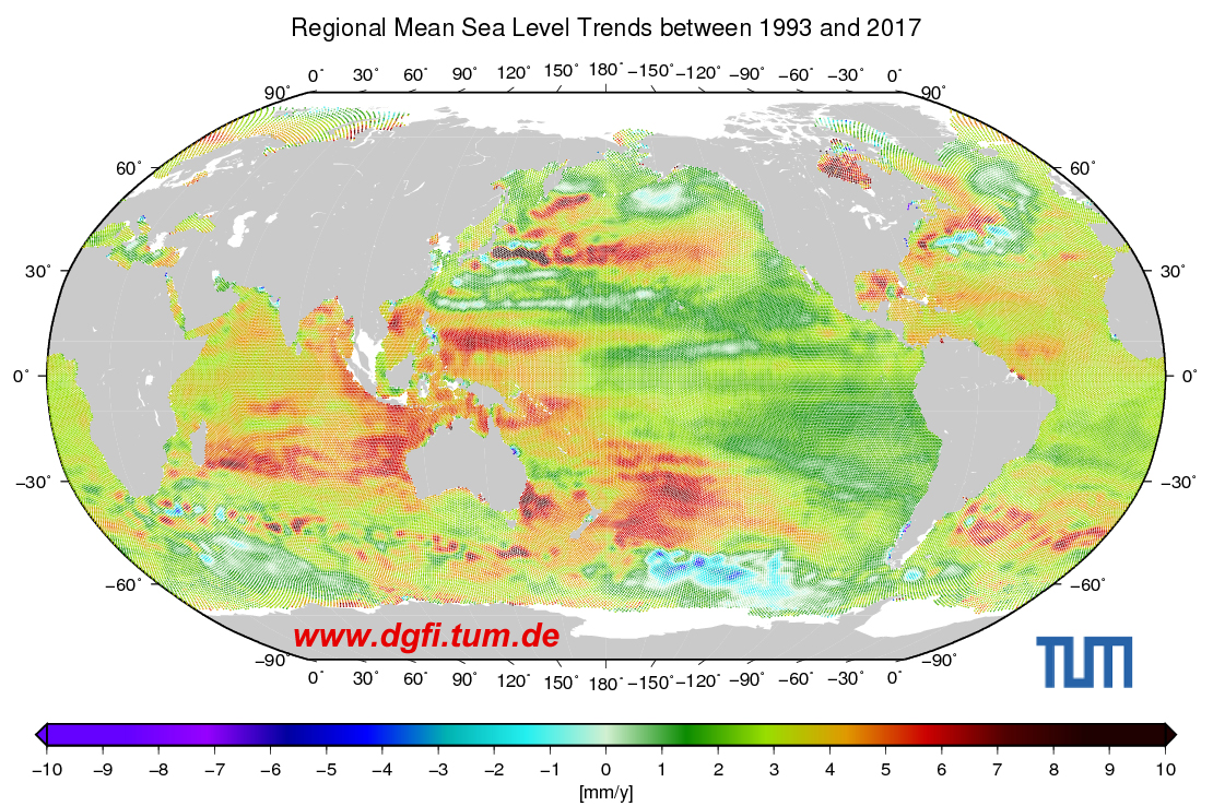
DGFI-TUM applies its cross-calibrated multi-mission altimetry dataset in studies of sea level change on global and regional scales over several decades. The combination of different successive missions provides long-term time series and stable trend estimates. In addition, analysis of mission data from different orbits improves spatial data distribution and allows for the extraction of refined regional information.
One of the most challenging tasks in deriving regional sea level trends is to transition from along-track measurements (ground track profiles) to regular grids and calculate representative global or regional averages. Depending on the interpolation method, different errors may result in the calculated sea level trends that need to be treated accordingly. Other challenges include shallow water areas, coastal regions, and areas (temporarily) covered by sea ice, where special pre-processing of the data needs to be developed. In addition to sea level changes and trends on global and regional scales, DGFI-TUM aims to estimate reliable error information for the calculated changes.
Information of the mean sea level and its evolution can be found at OpenADB.
Related projects
- Baltic+ Sea Level (Baltic SEAL)
- Sea Level Climate Change Initiative (SLCCI)
- Coastal Ocean and Inland Water Altimetry (HYDROCOASTAL)
Related data products
- Sea Level Changes in the North Sea (1995-2019): North SEAL
- Sea Level Changes in the Baltic Sea (1995-2019): Baltic SEAL
Selected Publications
 (Open Access)
(Open Access)
(Open Access)
(Open Access)
(Open Access)
(Open Access)
(Open Access)
(Open Access)
(Open Access)
Arcisstraße 21
80333 München